Rivers are large natural streams. Feeding from precipitation, glaciers or underground sources, they are the main reservoirs of fresh water on the planet. According to the nature of the area in which they flow, mountain and lowland rivers are distinguished. Examples of both streams are found on all continents. Their appearance and many characteristics are not the same. We will talk more about how lowland rivers differ from mountain rivers later in the article.
What affects rivers?
The nature and appearance of the planet's watercourses depend on a huge number of factors. They are mainly determined by the climate, geological structure and landscape of the area. So, during heavy rainfall, rivers can overflow their banks, flooding nearby territories. But the long absence of precipitation in hot countries leads to the fact that watercourses dry up completely, appearing only in a short rainy season.
If we talk about how mountain rivers differ from lowland rivers, then first of all we need to mention the relief. It is he who determines the speed at which water flows, what size, shape, depth the channel and valley will have. In addition to the relief, the formation of rivers is also influenced by the geological structure of the territory. Together they affect the transparency of water, what obstacles it encounters on its way. Now let's find out in more detail how lowland rivers differ from mountain rivers and how all the factors mentioned above act on them.
Water and flow rate
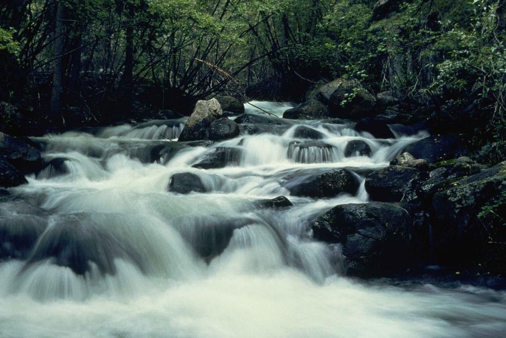
Mountain rivers are fast, swift streams, with a flow speed of 1 meter per second and higher (sometimes more than 5 m / s). They flow mainly in the mountains or on the hills. They often form in places where rocks come to the surface, so their waters are usually not very turbid. The most famous examples of such watercourses are the Congo, Colorado, Yangtze.
The relief of our planet is very heterogeneous. Where high ridges gradually turn into lowlands and plateaus, mountain rivers turn into flat ones. The Terek, flowing in the North Caucasus, can be such an example.
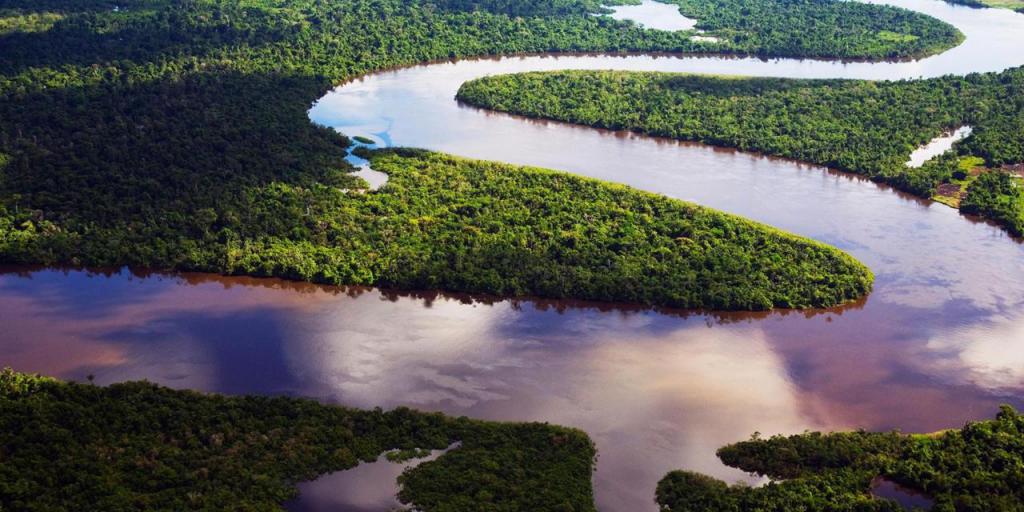
Plain rivers flow calmer and slower. Their speed usually does not exceed one meter per second. An example of such watercourses is the Amazon, the Nile, the Mississippi, the Volga, the Dnieper. Why is a mountain river faster than a flat one? Everything is obvious here - because of the greater elevation difference. Mountain rivers begin at higher elevations, which means that their angle of incidence is much greater.
One of the main parameters that characterizes a river is its slope. It is the ratio of the height of the fall of the watercourse (or its section) to its length. In mountain rivers, it can be 5-80 m / km, while in flat rivers it is only a few centimeters per kilometer of length.
river valley shape
All rivers arise from tiny streams that have appeared from an excess of water (heavy rainfall, melting snow, overcrowded swamps or lakes, etc.). They form their own path, punching furrows in the soil and rocks. The deepening of the earth's surface formed by a watercourse is called a valley, and the deepest section where it flows directly is called a channel.
What is the difference between mountain rivers and lowland rivers? With their outlines. Low-lying streams have too little speed. Their flow is unable to overcome the barrier, so it goes around it. The valleys of such rivers are wide, and the channels are winding. Their smooth bends are called meanders, after the name of the Great Menderes River in Turkey. Plain watercourses do not go deep into the surface of the earth and often overflow during floods, forming floodplains.
In mountain rivers, everything is exactly the opposite. They have great speed, which is why their channels are even, and the valleys are narrow and deep. They are not characterized by wide floodplains and terraces. As a rule, the channel occupies the entire valley entirely.
Rapids, canyons, waterfalls
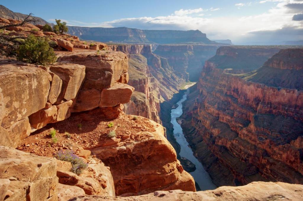
Mountain rivers, as a rule, are formed in places where the foundation is composed of solid rocks. Grinding them down and deepening, they form canyons and gorges, which, in fact, are valleys with steep slopes and a very narrow bottom. The longest canyon in the world is located in Greenland and is hidden under a layer of ice. One of the deepest on the planet is the Grand Canyon in Arizona.
The difficult mountainous terrain also contributes to the formation of rapids along the path of water. These are stones and small rocks that come to the surface of the river, blocking the way for ships and boats. From the erosion of rocks at the bottom of the channel, sharp ledges are sometimes formed, from which water does not drain, but literally falls. Such places are called waterfalls. The largest of them are Angel, Victoria, Niagara.
Rapids, canyons and waterfalls can also form on flat rivers, for example, Smotrychsky (Ukraine) and Reutsky (Moldova) canyons, Bensky rapids on the Volga. However, they are more common in mountainous regions.
Plain and mountain rivers of Russia
More than 2.5 million rivers and small streams flow on the territory of the country. However, there are only 140 thousand large watercourses with a length of more than 10 kilometers. There are few classical mountain rivers among them, because many of them become flat along their way. Nevertheless, Terek, Samur, Kuban, Katun, Sulak can be mentioned as an example.
The southernmost of the largest watercourses in Russia is the Kuban River. It starts on Elbrus in the Karachay-Cherkess Republic. The Kuban is formed from the confluence of two other rivers - Ullukam and Uchkulan - and flows into the Sea of Azov. It stretches for 870 kilometers in length, and the height difference from its source to the mouth is 1339 meters.
The plain rivers of Russia are the Ob, Volga, Yenisei, Don. The Ob is the longest in the country and one of the longest in the world. From the confluence of the Biya and Katun, it stretches for 3650 kilometers, flowing into the Kara Sea. In terms of basin area, it is the third in Russia, and in terms of water consumption, it is the third after the Lena and the Yenisei.