Currently, the global volume of ice is over 20 million cubic kilometers. According to some scientists, it takes more than 5,000 years for all of it to melt. If humanity continues to burn fossil fuels, it is very likely that we will end up with an ice-free planet with an average temperature of 26°C instead of the current 14°C.
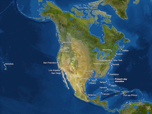
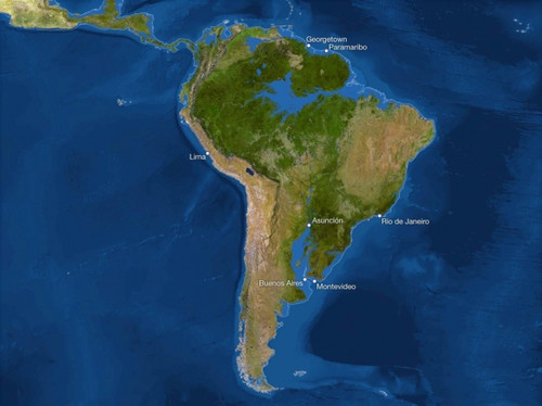
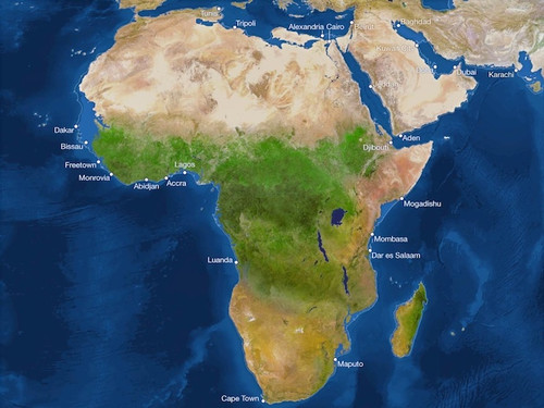
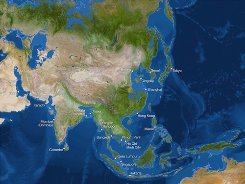
The presented maps show our world as it looks now, with one difference: all the ice on Earth turned into water, which led to a rise in sea levels by 65 meters and the formation of new coastlines along the continents and inland seas.
So, let's see what a "melted" world can be like.
North America
The entire Atlantic coast along Florida and the Gulf of Mexico will disappear. The hills of San Francisco in California will become a cluster of islands, and the Central Valley will become a giant bay. The Gulf of California will extend north above the latitude of San Diego.
South America
The Amazon Basin to the north and the Paraguay River Basin to the south would become Atlantic inlets, wiping out Buenos Aires, Uruguay's coastal regions, and much of Paraguay. Mountainous areas would have survived along the Caribbean coast and in Central America.
Africa
Compared to other continents, Africa will lose the least amount of land due to rising sea levels, but rising global temperatures could make many of its territories uninhabitable. In Egypt, Alexandria and Cairo will be flooded by the Mediterranean Sea.
Europe
London will remain only a memory, as will Venice, swallowed up by the Adriatic Sea. Thousands of years later, according to this catastrophic scenario, the Netherlands and most of Denmark will also go under water. At the same time, the Black and Caspian Seas, fed by Mediterranean waters, will grow ever stronger.
![]()
Asia
Lands now home to 600 million Chinese will be flooded, as will Bangladesh of 160 million and much of coastal India. In Cambodia, in the Mekong Delta, only the Cardamom Mountains will remain in the form of an island on the shallows.
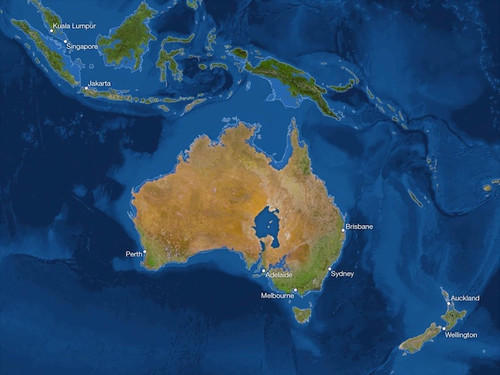
Australia
The largely desert continent would gain a new inland sea - but would lose much of the narrow coastal strip that currently houses four-fifths of the population.
Antarctic
The East Antarctica ice sheet is so large (accounting for four-fifths of all ice on Earth) that it may seem stable. He survived the previous warm periods, remaining unscathed. But recently, due to global warming, its thickening is quite insignificant. Although the warmer the atmosphere, the more it contains water vapor, which falls on the region in the form of snow. But even this "ice monster" is unlikely to withstand the return of the climate of the Eocene era.
Like the Greenland ice sheet, West Antarctica was apparently much smaller during earlier periods of warming. These regions are vulnerable, since most of their territory is rock, located below sea level. When the ocean warms, the ice sheet melts from below, which contributes to its destruction. Since 1992, it has lost an average of 65 million tons of ice per year.