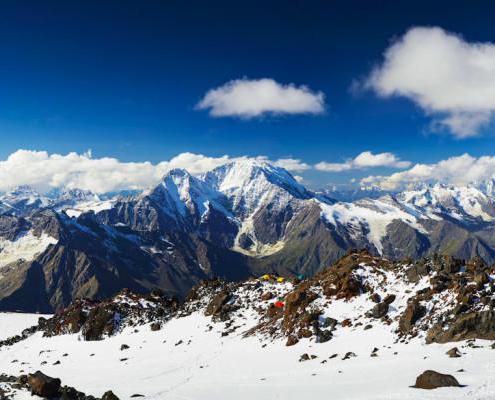
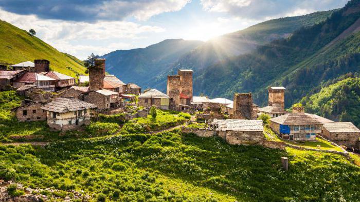
Surprisingly beautiful mountain landscapes can be seen in these wonderful and unique places. The most impressive peaks are the Greater Caucasus Range. This is the territory of the highest and largest mountains in the Caucasus region.
The Lesser Caucasus and the valleys (Riono-Kura depression) represent Transcaucasia in the complex.
Caucasus: general description
The Caucasus is located between the Caspian Sea and the Black Sea in southwestern Asia.
This region includes the mountains of the Greater and Lesser Caucasus, as well as the depression between them called the Riono-Kura depression, the coasts of the Black Sea and the Caspian Seas, the Stavropol Upland, a small part of the Caspian lowland (Dagestan) and the Kuban-Azov lowland to the left bank of the Don River on part of its mouth.
The mountains of the Greater Caucasus have a length of 1500 kilometers, and the highest peak is Elbrus. The length of the Lesser Caucasus Mountains is 750 km.
A little lower, let's take a closer look at the Caucasus Range.
Geographical position
In the western part, the Caucasus borders on the Black and Azov seas, in the east - on the Caspian. In the north, the East European Plain extends, and the border between it and the Caucasian foothills repeats the latter passes along the river. Kuma, the bottom of the Kumo-Manych depression, along the Manych and Vostochny Manych rivers, and then along the left bank of the Don.
The southern border of the Caucasus is the Araks River, behind which are the Armenian and Iranian Highlands, and the river. Chorokh. And already beyond the river, the peninsulas of Asia Minor begin.
Caucasian Range: description
The most courageous people and climbers have long chosen the Caucasian mountain range, which attracts extreme people from all over the world.
The most important Caucasian ridge divides the entire Caucasus into 2 parts: Transcaucasia and the North Caucasus. This mountain range extends from the Black Sea to the shores of the Caspian Sea.
The length of the Caucasus Range is more than 1200 kilometers.
The site, located on the territory of the reserve, represents the highest mountain ranges of the Western Caucasus. Moreover, the heights here are the most diverse. Their marks vary from 260 to more than 3360 meters above sea level.
The perfect combination of mild mild climate and amazing landscapes make this place ideal for an active tourist holiday at any time of the year.
The main Caucasian ridge on the Sochi territory has the largest peaks: Fisht, Khuko, Lysaya, Venets, Grachev, Pseashkho, Chugush, Malaya Chura and Assara.
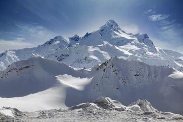
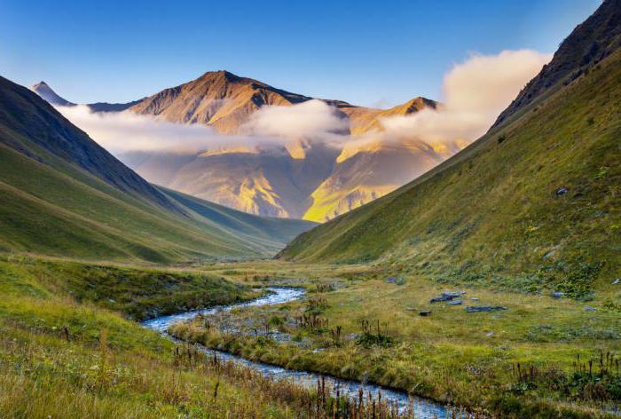
The composition of the rocks of the ridge: limestones and marls. There used to be an ocean floor here. Throughout the vast massif, one can observe a pronounced folding with numerous glaciers, turbulent rivers and mountain lakes.
About the height of the Caucasus Range
The peaks of the Caucasus Range are numerous and quite diverse in height.
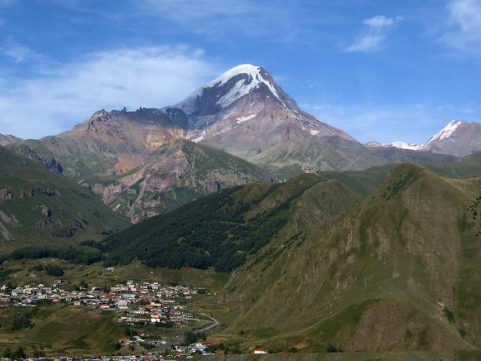
Elbrus is the highest point of the Caucasus, which is the highest peak not only in Russia, but also in Europe. The location of the mountain is such that a variety of nationalities live around it, giving it their unique names: Oshkhomakho, Alberis, Yalbuz and Mingitau.
The most important mountain in the Caucasus ranks fifth on Earth among mountains formed in this way (as a result of a volcanic eruption).
The height of the most gigantic peak in Russia is five kilometers six hundred and forty-two meters.
More details about the highest peak of the Caucasus
The highest height of the Caucasus Range is Russia. It looks like two cones, between which (a distance of 3 km from each other) at an altitude of 5200 meters there is a saddle. The highest of them has, as already noted, a height of 5642 meters, a smaller one - 5621m.
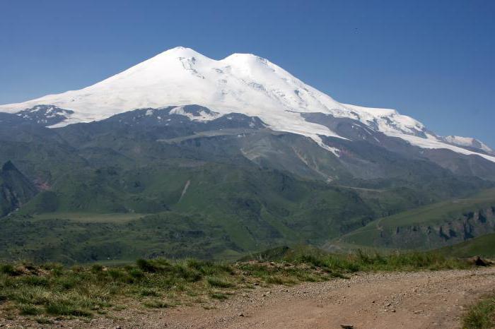
Like all peaks of volcanic origin, Elbrus consists of 2 parts: a 700-meter pedestal of rocks and a bulk cone (1942 meters) - the result of a volcanic eruption.
The peak is covered with snow starting from a height of about 3500 meters. In addition, there are glaciers, the most famous of which are the Small and Big Azau and Terskop.
The temperature at the highest point of Elbrus is -14 °C. Precipitation here almost always falls in the form of snow and therefore the glaciers do not melt. Due to the good visibility of the Elbrus peaks from different remote places and at different times of the year, this mountain also has an interesting name - Small Antarctica.
It should be noted that for the first time the eastern peak was conquered by climbers in 1829, and the western one - in 1874.
Glaciers located on the top of Elbrus feed the Kuban, Malka and Baksan rivers.
Central Caucasus: ridges, parameters
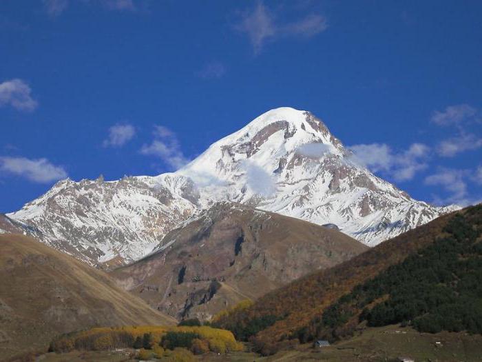
Geographically, the Central Caucasus is part of the Greater Caucasus, located between the mountains of Elbrus and Kazbek (in the west and in the east). In this section, the length of the Main Caucasian Range is 190 kilometers, and if we take into account the meanders, about 260 km.
The border of the Russian state passes through the territory of the Central Caucasus. Behind it are South Ossetia and Georgia.
22 kilometers west of Kazbek (eastern part of the Central Caucasus), the Russian border shifts slightly to the north and runs to Kazbek, skirting the Georgian-owned Terek valley (upper part).
On the territory of the Central Caucasus, 5 parallel ridges are distinguished (oriented along the latitudes):
- The main Caucasian ridge (height up to 5203 m, Mount Shkhara).
- Ridge Lateral (height up to 5642 meters, Mount Elbrus).
- Ridge Rocky (height up to 3646 meters, Mount Karakaya).
- Ridge Pastbishchny (up to 1541 meters).
- Ridge Wooded (height 900 meters).
Tourists and climbers mainly visit and storm the first three ridges.
North and South Caucasus
The Greater Caucasus, as a geographical object, originates from the Taman Peninsula, and ends in the region. All subjects of the Russian Federation and countries located in this region belong to the Caucasus. However, in terms of the location of the territories of the constituent entities of Russia, there is a certain division into two parts:
- The North Caucasus includes the Krasnodar Territory and Stavropol Territory, North Ossetia, the Rostov Region, Chechnya, the Republic of Adygea, Ingushetia, Kabardino-Balkaria, Dagestan and Karachay-Cherkessia.
- South Caucasus (or Transcaucasia) - Armenia, Georgia, Azerbaijan.
Elbrus region
The Elbrus region is geographically the westernmost section of the Central Caucasus. Its territory covers the upper reaches of the Baksan River with its tributaries, the area north of Elbrus and the western spurs of Mount Elbrus to the right bank of the Kuban. The largest peak of this region is the famous Elbrus, located to the north and located in the Side Range. The second highest peak is (4700 meters).
The Elbrus area is famous for a large number of peaks with steep ridges and rocky walls.
The largest glaciers are concentrated in the huge Elbrus glacier complex, which has 23 glaciers (total area - 122.6 sq. km).
Location of states in the Caucasus
- The Russian Federation partially occupies the territory of the Greater Caucasus and its foothills from the Dividing and Main Caucasian Ranges to the north. 10% of the total population of the country lives in the North Caucasus.
- Abkhazia also has territories that are parts of the Greater Caucasus: the area from the Kodori to the Gagra ranges, the Black Sea coast between the river. Psou and Enguri, and to the north of Enguri a small part of the Colchis lowland.
- South Ossetia is located in the central region of the Greater Caucasus. The beginning of the territory is the Main Caucasian Range. The territory extends in a southerly direction from it, between the Rachinsky, Suramsky and Lomissky ranges, to the very valley of the Kura River.
- Georgia has the most fertile and populated parts of the country in the valleys and lowlands between the Lesser and Greater Caucasus ranges to the west of the Kakheti range. The most mountainous parts of the country are Svaneti, a section of the Greater Caucasus between the Kodori and Suram ranges. The Georgian territory of the Lesser Caucasus is represented by the Meskheti, Samsar and Trialeti ranges. It turns out that the whole of Georgia is within the Caucasus.
- Azerbaijan is located between the Dividing Range in the north and the Araks and Kura rivers in the south, and between the Lesser Caucasus and the Kakheti Range and the Caspian Sea. And almost all of Azerbaijan (the Mugan Plain and the Talysh Mountains belong to the Iranian Highlands) is located in the Caucasus.
- Armenia has part of the territory of the Lesser Caucasus (slightly east of the Akhuryan River, which is a tributary of the Araks).
- Turkey occupies the southwestern section of the Lesser Caucasus, representing 4 eastern provinces of this country: Ardahan, Kars, partly Erzurum and Artvin.
The mountains of the Caucasus are both beautiful and dangerous. According to the assumptions of some scientists, there is a possibility that in the next hundred years the volcano (Mount Elbrus) may wake up. And this is fraught with catastrophic consequences for neighboring regions (Karachay-Cherkessia and Kabardino-Balkaria).
But, whatever it may be, the conclusion follows that there is nothing more beautiful than the mountains. It is impossible to describe all the magnificent nature of this fabulous mountain country. To feel it all, you should visit these amazingly beautiful paradise places. They are especially impressively viewed from the heights of the peaks of the Caucasus Mountains.