Without the Russian pioneers, the map of the world would be completely different. Our compatriots - travelers and navigators - have made discoveries that have enriched world science. About the eight most notable - in our material.
Bellingshausen's first Antarctic expedition
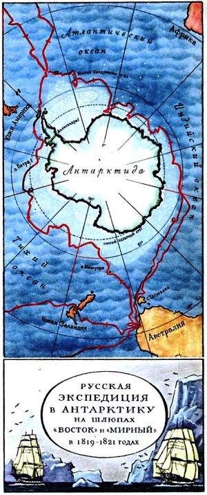
In 1819, the navigator, captain of the 2nd rank, Thaddeus Bellingshausen led the first Antarctic expedition around the world. The purpose of the voyage was to explore the waters of the Pacific, Atlantic and Indian oceans, as well as to prove or disprove the existence of the sixth continent - Antarctica. Having equipped two sloops - "Mirny" and "Vostok" (under the command), Bellingshausen's detachment went to sea.
The expedition lasted 751 days and wrote many bright pages in the history of geographical discoveries. The main one - - was made on January 28, 1820.
By the way, attempts to open the white mainland were made earlier, but did not bring the desired success: there was not enough luck, or maybe Russian perseverance.
So, the navigator James Cook, summing up his second circumnavigation, wrote: “I went around the ocean of the southern hemisphere in high latitudes and rejected the possibility of the existence of a mainland, which, if it can be found, is only near the pole in places inaccessible to navigation.”
During the Antarctic expedition of Bellingshausen, more than 20 islands were discovered and mapped, sketches were made of the views of Antarctica and the animals living on it, and the navigator himself went down in history as a great discoverer.
“The name of Bellingshausen can be directly put on a par with the names of Columbus and Magellan, with the names of those people who did not retreat before the difficulties and imaginary impossibilities created by their predecessors, with the names of people who went their own way, and therefore were the destroyers of barriers to discoveries, by which epochs are designated, ”wrote the German geographer August Petermann.
Discoveries of Semenov Tien-Shansky
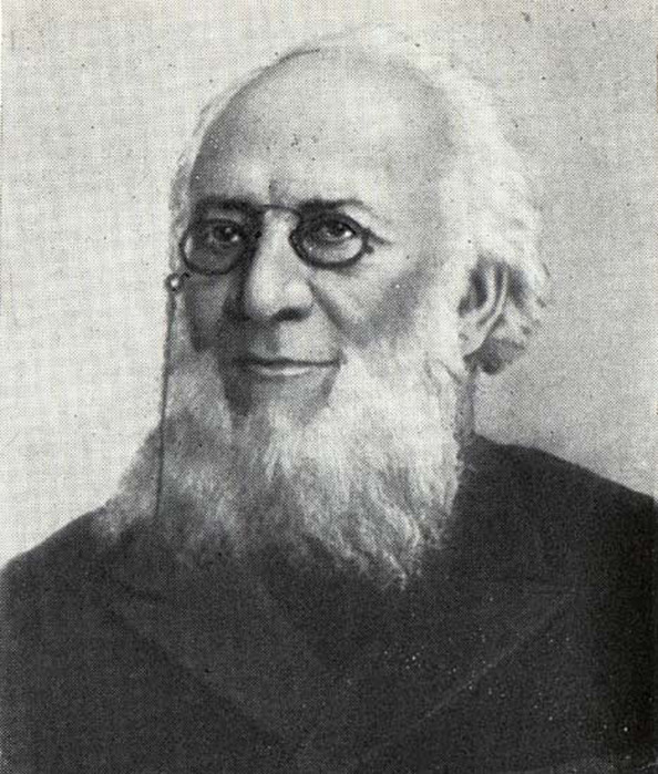
Central Asia at the beginning of the 19th century was one of the least explored areas of the globe. An indisputable contribution to the study of the "unknown land" - as geographers called Central Asia - was made by Peter Semenov.
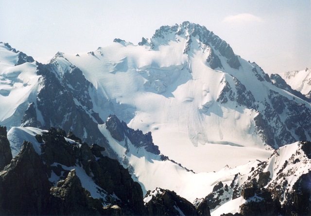
In 1856, the main dream of the researcher came true - he went on an expedition to the Tien Shan.
“My work on Asian geography led me to a detailed acquaintance with everything that was known about inner Asia. In particular, the most central of the Asian mountain ranges, the Tien Shan, attracted me to itself, on which the foot of a European traveler had not yet set foot and which was known only from scarce Chinese sources.
Semenov's research in Central Asia lasted two years. During this time, the sources of the Chu, Syrdarya and Sary-Jaz rivers, the peaks of Khan-Tengri and others were put on the map.
The traveler established the location of the Tien Shan ranges, the height of the snow line in this area and discovered the huge Tien Shan glaciers.
In 1906, by decree of the emperor, for the merits of the discoverer, they began to add a prefix to his surname - Tien Shan.
Asia Przewalski
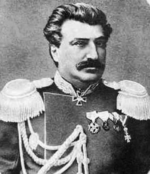
In the 70s-80s. XIX century Nikolai Przhevalsky led four expeditions to Central Asia. This little explored area has always attracted the researcher, and traveling to Central Asia was his old dream.
Over the years of research, mountain systems have been studied Kun-Lun , the ranges of Northern Tibet, the sources of the Yellow River and the Yangtze, basins Kuku-burrow and Lob-burrow.
Przhevalsky was the second person after Marco Polo to reach lakes-bogs Lob-burrow!
In addition, the traveler discovered dozens of species of plants and animals that are named after him.
“Happy fate made it possible to make a feasible study of the least known and most inaccessible countries of inner Asia,” Nikolai Przhevalsky wrote in his diary.
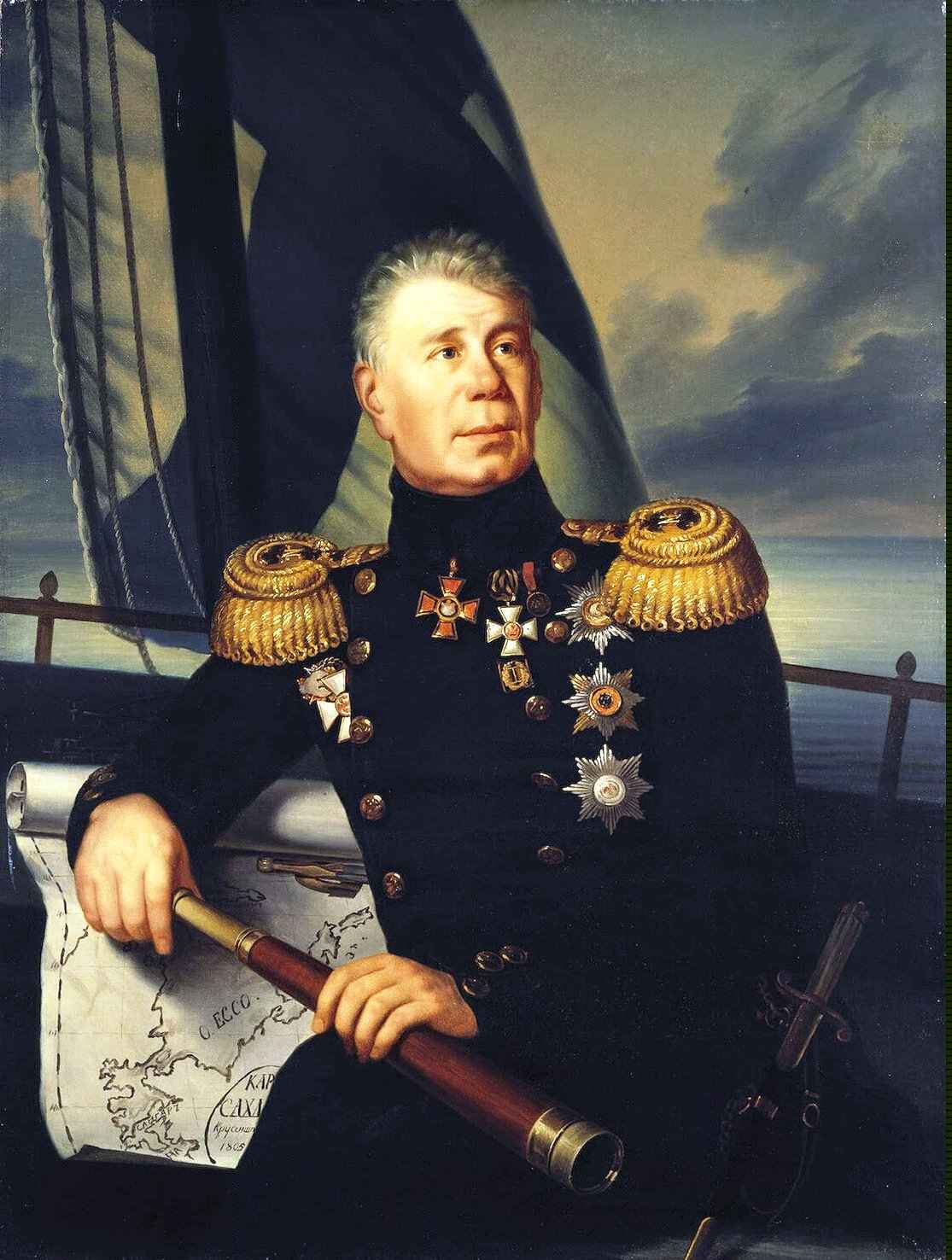
Around the world Krusenstern
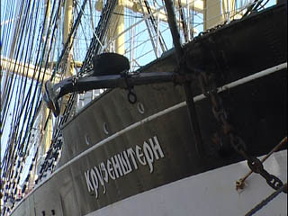
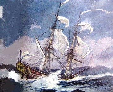
The names of Ivan Kruzenshtern and Yuri Lisyansky became known after the first Russian round-the-world expedition.
For three years, from 1803 to 1806. - this is how long the first circumnavigation of the world lasted - the ships "Nadezhda" and "Neva", having passed through the Atlantic Ocean, rounded Cape Horn, and then reached Kamchatka, the Kuril Islands and Sakhalin by the waters of the Pacific Ocean. The expedition refined the map of the Pacific Ocean, collected information about the nature and inhabitants of Kamchatka and the Kuriles.
During the voyage, Russian sailors crossed the equator for the first time. This event was celebrated, according to tradition, with the participation of Neptune.
A sailor dressed as the ruler of the seas asked Kruzenshtern why he had come here with his ships, because the Russian flag had not been seen in these places before. To which the expedition commander replied: "For the glory of science and our fatherland!"
Expedition of Nevelskoy
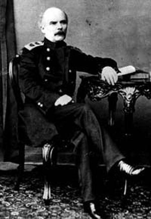
Admiral Gennady Nevelskoy is rightfully considered one of the outstanding navigators of the 19th century. In 1849, on the transport ship Baikal, he went on an expedition to the Far East.
The Amur expedition continued until 1855, during which time Nevelskoy made several major discoveries in the area of the lower reaches of the Amur and the northern shores of the Sea of Japan, and annexed vast expanses of the Amur and Primorye to Russia.
Thanks to the navigator, it became known that Sakhalin is an island, which is separated by the navigable Tatar Strait, and the mouth of the Amur is accessible for ships to enter from the sea.
In 1850, the Nikolaevsky post was founded by the Nevelsky detachment, which today is known as Nikolaevsk-on-Amur.
“The discoveries made by Nevelsky are invaluable for Russia,” wrote Count Nikolai Muravyov-Amursky , - many previous expeditions to these lands could achieve European fame, but not one of them achieved domestic benefit, at least to the extent that Nevelskoy did it.
North Vilkitsky
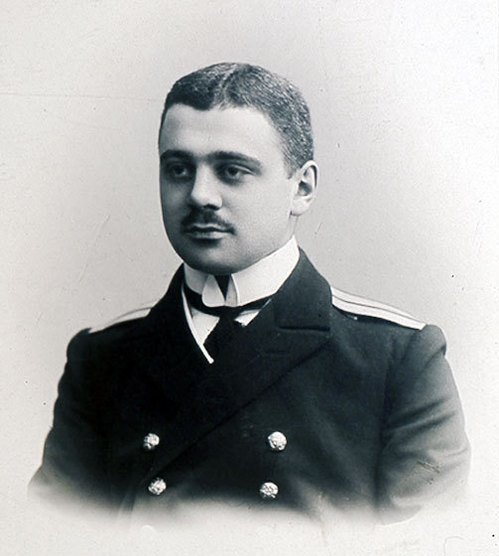
The purpose of the hydrographic expedition of the Arctic Ocean in 1910-1915. was the development of the Northern Sea Route. By chance, the captain of the 2nd rank Boris Vilkitsky assumed the duties of the head of navigation. The icebreaking ships Taimyr and Vaygach put to sea.
Vilkitsky moved through the northern waters from east to west, and during the voyage he managed to compile a true description of the northern coast of Eastern Siberia and many islands, received the most important information about currents and climate, and also became the first who made a through voyage from Vladivostok to Arkhangelsk.
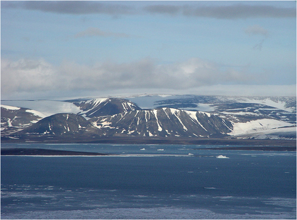
The expedition members discovered the Land of Emperor Nicholas I. I., known today as Novaya Zemlya - this discovery is considered the last of the significant ones on the globe.
In addition, thanks to Vilkitsky, the islands of Maly Taimyr, Starokadomsky and Zhokhov were put on the map.
At the end of the expedition, the First World War began. Traveler Roald Amundsen, having learned about the success of Vilkitsky's voyage, could not resist exclaiming to him:
“In peacetime, this expedition would stir up the whole world!”
Kamchatka campaign of Bering and Chirikov
The second quarter of the 18th century was rich in geographical discoveries. All of them were made during the First and Second Kamchatka expeditions, which immortalized the names of Vitus Bering and Alexei Chirikov.
During the First Kamchatka campaign, Bering, the leader of the expedition, and his assistant Chirikov explored and mapped the Pacific coast of Kamchatka and Northeast Asia. They discovered two peninsulas - Kamchatsky and Ozerny, Kamchatsky Bay, Karaginsky Bay, Cross Bay, Providence Bay and St. Lawrence Island, as well as the strait, which today bears the name of Vitus Bering.
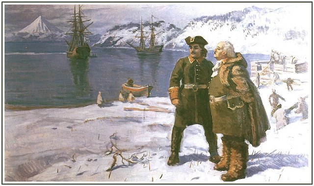
Companions - Bering and Chirikov - also led the Second Kamchatka Expedition. The goal of the campaign was to find a route to North America and explore the islands of the Pacific.
In Avacha Bay, the expedition members founded the Petropavlovsk prison - in honor of the ships of the voyage "Saint Peter" and "Saint Pavel" - which was later renamed Petropavlovsk-Kamchatsky.
When the ships set sail for the shores of America, by the will of evil fate, Bering and Chirikov began to act alone - because of the fog, their ships lost each other.
"Saint Peter" under the command of Bering reached the western coast of America.
And on the way back, the expedition members, who had many difficulties, were thrown by a storm onto a small island. Here the life of Vitus Bering ended, and the island on which the expedition members stopped to spend the winter was named after Bering.
"Saint Pavel" Chirikov also reached the shores of America, but for him the voyage ended more safely - on the way back he discovered a number of islands of the Aleutian ridge and safely returned to the Peter and Paul prison.
"Non-Yasak Lands" by Ivan Moskvitin
Little is known about the life of Ivan Moskvitin, but this man nevertheless went down in history, and the reason for this was the new lands he discovered.
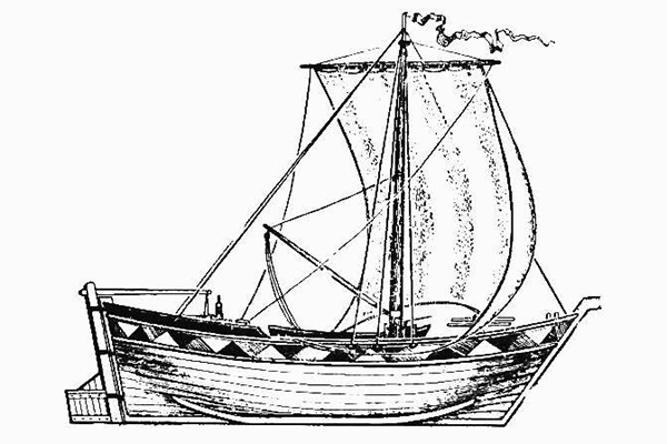
In 1639, Moskvitin, leading a detachment of Cossacks, set sail for the Far East. The main goal of the travelers was to "find new unclaimed lands", to collect furs and fish. The Cossacks crossed the rivers Aldan, Maya and Yudoma, discovered the Dzhugdzhur ridge, which separates the rivers of the Lena basin from the rivers flowing into the sea, and along the Ulya river they entered the Lamskoye, or Sea of Okhotsk. Having explored the coast, the Cossacks opened the Taui Bay and entered the Sakhalin Bay, rounding the Shantar Islands.
One of the Cossacks said that the rivers in the open lands “are sable, there are many animals, and fish, and the fish is big, there is no such thing in Siberia ... there are so many of them - just run a net and you can’t drag it out with fish ... ".
The geographical data collected by Ivan Moskvitin formed the basis of the first map of the Far East.